
Historic Site · San Ignacio, Belize
Xunantunich
Xunantunich is an ancient Maya archaeological site in western Belize, about 70 miles (110 km) west of Belize City, in the Cayo District. Built c. 700–900 AD. It drew 100,939 visitors in 2019.
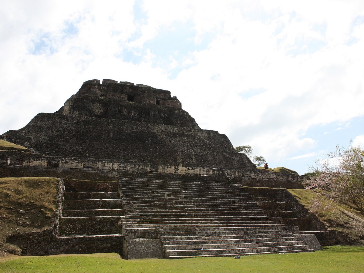
Photo: Infrogmation via Wikimedia Commons, CC0. Cropped and resized for display.
Landmark facts
| Location | San Ignacio, Belize |
|---|---|
| Type | Historic Site |
| Built | c. 700–900 AD |
| Height | Height: 40 m |
| Annual visitors (2019) | 100,939 |
| Coordinates | 17.0891° N, 89.1414° W |
Every fact above is taken from the sources listed below; anything no source states is left blank rather than guessed.
What Xunantunich is known for
Xunantunich is an ancient Maya archaeological site in western Belize, about 70 miles (110 km) west of Belize City, in the Cayo District.
About Xunantunich
Xunantunich is an ancient Maya archaeological site in western Belize, about 70 miles (110 km) west of Belize City, in the Cayo District. Xunantunich is located atop a ridge above the Mopan River, well within sight of the Guatemala border – which is 0.6 miles (1 km) to the west. It served as a Maya civic ceremonial centre of the Belize Valley region in the Late and Terminal Classic periods (c. 700–900 AD).
History
The first modern explorations of the site were conducted by Thomas Gann in the mid-1890s. Gann's successor, Sir J. Eric S. Thompson, implemented a more methodical approach, and was able to establish the region's first ceramic chronology in 1942. In 1959–60, the Cambridge Expedition to British Honduras arrived in the colony, and its archaeologist member, Euan MacKie, carried out several months of excavation at Xunantunich.
How to get there
| Nearest town | San Ignacio |
|---|---|
| Nearest airport | Mundo Maya International Airport (FRS) |
| Distance from the airport | 50.4 miles (straight line) |
Nearest major airport by straight-line distance from the landmark’s coordinates; road distance will be longer.
Airports near this landmark
The airports a visitor would actually fly into, nearest first — each link opens its profile on our sister site AirportProfiles.
- Philip S. W. Goldson International Airport (BZE) · Belize City, Belize · 63.4 miles away
- Ramón Villeda Morales International Airport (SAP) · San Pedro Sula, Honduras · 139.0 miles away
Landmarks nearby
The closest landmarks in this library, by straight-line distance.
More landmarks in Belize
More historic sites





Frequently asked questions
What is Xunantunich?
Xunantunich is an ancient Maya archaeological site in western Belize, about 70 miles (110 km) west of Belize City, in the Cayo District.
Where is Xunantunich located?
Xunantunich is in San Ignacio, Belize. Its coordinates are 17.0891° N, 89.1414° W.
How do I get to Xunantunich?
The nearest town is San Ignacio, and the nearest airport is Mundo Maya International Airport (FRS), about 50.4 miles away (straight line).
When was Xunantunich built?
Xunantunich was built c. 700–900 AD.
Sources
- https://en.wikipedia.org/wiki/Xunantunich — Wikipedia article — overview, history and core facts (CC BY-SA).
- https://www.wikidata.org/wiki/Q1646630 — Wikidata — built year, architect, height/size, visitors, official website (CC0).
- https://github.com/jbrooksuk/JSON-Airports — Nearest major airport computed from landmark and airport coordinates (haversine); airport list: jbrooksuk/JSON-Airports.
Page last updated 13 November 2026.