
Historic Site · Hatra, Iraq
Hatra
Hatra was an ancient city in Upper Mesopotamia located in present-day eastern Nineveh Governorate in northern Iraq.
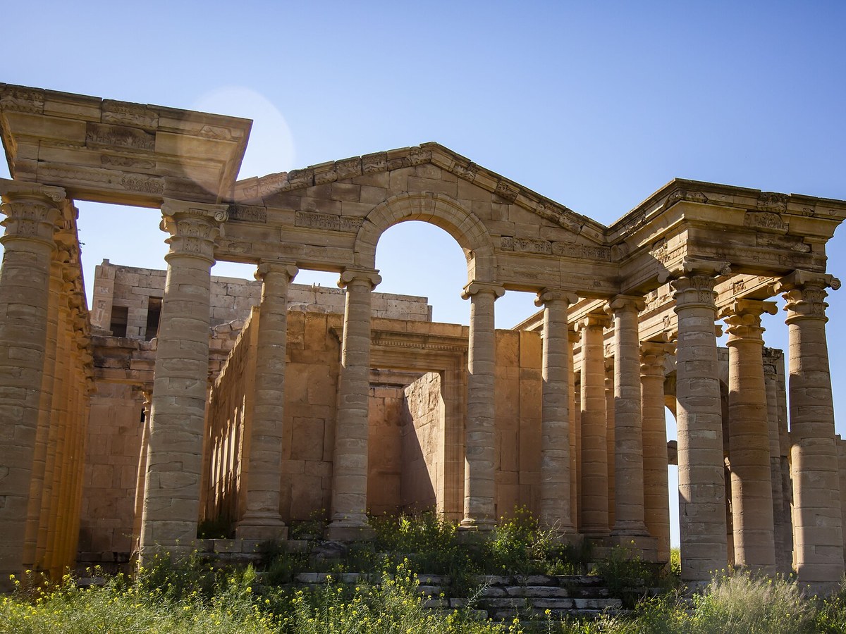
Photo: Husseinal-mauktar via Wikimedia Commons, CC BY-SA 4.0. Cropped and resized for display.
Landmark facts
| Location | Hatra, Iraq |
|---|---|
| Type | Historic Site |
| Area | Area: 3.24 km² |
| Coordinates | 35.5881° N, 42.7183° E |
Every fact above is taken from the sources listed below; anything no source states is left blank rather than guessed.
What Hatra is known for
Hatra was an ancient city in Upper Mesopotamia located in present-day eastern Nineveh Governorate in northern Iraq.
About Hatra
Hatra was an ancient city in Upper Mesopotamia located in present-day eastern Nineveh Governorate in northern Iraq. The ruins of the city lie 290 km (180 mi) northwest of Baghdad and 110 km (68 mi) southwest of Mosul. It was a strongly fortified caravan city and capital of the Arab Kingdom of Hatra, located between the Roman and Parthian/Sasanian Empires. Hatra flourished in the 2nd century AD, and was destroyed by the Sassanid Empire and deserted in the 3rd century AD alongside other Neo-Assyrian populated states such as Assur, Adiabene, Osroene and Beth Nuhadra.
History
There is no archeological information on the city before the Parthian period but settlement in the area likely dates back to at least the Seleucid period. The foundation of Hatra is believed to date to the 3rd or 2nd century BCE under the Seleucid Kingdom. It flourished because of its strategic position along caravan trade routes in the 1st and 2nd centuries CE as the capital of the Kingdom of Araba (Hatra), a semi-autonomous kingdom under the Parthian influence. The city became the capital in the chain of largely Arab-controlled cities running from Hatra, in the northeast, via Palmyra, Baalbek and Petra, in the southwest.
How to get there
| Nearest town | Hatra |
|---|---|
| Nearest airport | Erbil International Airport (EBL) |
| Distance from the airport | 82.8 miles (straight line) |
Nearest major airport by straight-line distance from the landmark’s coordinates; road distance will be longer.
Airports near this landmark
The airports a visitor would actually fly into, nearest first — each link opens its profile on our sister site AirportProfiles.
- Erbil International Airport (EBL) · Arbil, Iraq · 82.0 miles away
- Kirkuk International Airport (KIK) · Kirkuk, Iraq · 92.1 miles away
Landmarks nearby
The closest landmarks in this library, by straight-line distance.
More landmarks in Iraq
More historic sites





Frequently asked questions
What is Hatra?
Hatra was an ancient city in Upper Mesopotamia located in present-day eastern Nineveh Governorate in northern Iraq.
Where is Hatra located?
Hatra is in Hatra, Iraq. Its coordinates are 35.5881° N, 42.7183° E.
How do I get to Hatra?
The nearest town is Hatra, and the nearest airport is Erbil International Airport (EBL), about 82.8 miles away (straight line).
What is the history of Hatra?
There is no archeological information on the city before the Parthian period but settlement in the area likely dates back to at least the Seleucid period. The foundation of Hatra is believed to date to the 3rd or 2nd century BCE under the Seleucid Kingdom.
Sources
- https://en.wikipedia.org/wiki/Hatra — Wikipedia article — overview, history and core facts (CC BY-SA).
- https://www.wikidata.org/wiki/Q466614 — Wikidata — built year, architect, height/size, visitors, official website (CC0).
- https://github.com/jbrooksuk/JSON-Airports — Nearest major airport computed from landmark and airport coordinates (haversine); airport list: jbrooksuk/JSON-Airports.
Page last updated 13 November 2026.