
Historic Site · Luxor, Egypt
Valley of the Kings
The Valley of the Kings, also known as the Valley of the Gates of the Kings, is an area in Egypt where, for a period of nearly 500 years from the Eighteenth Dynasty to the Twentieth Dynasty, rock-cut tombs were excavated for pharaohs and powerful nobles under the New Kingdom of ancient Egypt.
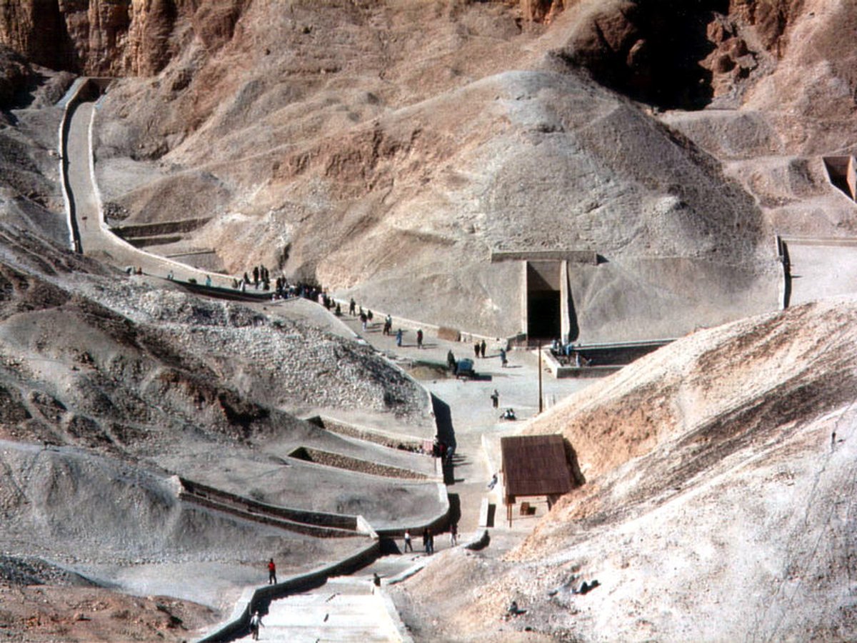
Photo: Fotograf/Photographer: Peter J. Bubenik (1995) via Wikimedia Commons, CC BY-SA 2.0. Cropped and resized for display.
Landmark facts
| Location | Luxor, Egypt |
|---|---|
| Type | Historic Site |
| Coordinates | 25.7408° N, 32.6022° E |
Every fact above is taken from the sources listed below; anything no source states is left blank rather than guessed.
What Valley of the Kings is known for
The Valley of the Kings, also known as the Valley of the Gates of the Kings, is an area in Egypt where, for a period of nearly 500 years from the Eighteenth Dynasty to the Twentieth Dynasty, rock-cut tombs were excavated for pharaohs and powerful nobles under the New Kingdom of ancient Egypt.
About Valley of the Kings
The Valley of the Kings, also known as the Valley of the Gates of the Kings, is an area in Egypt where, for a period of nearly 500 years from the Eighteenth Dynasty to the Twentieth Dynasty, rock-cut tombs were excavated for pharaohs and powerful nobles under the New Kingdom of ancient Egypt. It is a wadi sitting on the west bank of the Nile, opposite Thebes (modern-day Luxor) and within the heart of the Theban Necropolis. There are two main sections: the East Valley, where the majority of the royal tombs are situated; and the West Valley, otherwise known as the Valley of the Monkeys.
History
The Theban Hills are dominated by the peak of al-Qurn, known to the Ancient Egyptians as ta dehent, or "The Peak". It has a pyramid-shaped appearance, and it is probable that this echoed the pyramids of the Old Kingdom, more than a thousand years prior to the first royal burials carved here. Its isolated position also resulted in reduced access, and special tomb police (the Medjay) were able to guard the necropolis.
How to get there
| Nearest town | Luxor |
|---|---|
| Nearest airport | Luxor International Airport (LXR) |
| Distance from the airport | 7.6 miles (straight line) |
Nearest major airport by straight-line distance from the landmark’s coordinates; road distance will be longer.
Airports near this landmark
The airports a visitor would actually fly into, nearest first — each link opens its profile on our sister site AirportProfiles.
- Luxor International Airport (LXR) · Luxor, Egypt · 8.1 miles away
- Suhaj International Airport (HMB) · Suhaj, Egypt · 67.6 miles away
- Hurghada International Airport (HRG) · Hurghada, Egypt · 123.7 miles away
Landmarks nearby
The closest landmarks in this library, by straight-line distance.
More landmarks in Egypt
More historic sites





Frequently asked questions
What is Valley of the Kings?
The Valley of the Kings, also known as the Valley of the Gates of the Kings, is an area in Egypt where, for a period of nearly 500 years from the Eighteenth Dynasty to the Twentieth Dynasty, rock-cut tombs were excavated for pharaohs and powerful nobles under the New Kingdom of ancient Egypt.
Where is Valley of the Kings located?
Valley of the Kings is in Luxor, Egypt. Its coordinates are 25.7408° N, 32.6022° E.
How do I get to Valley of the Kings?
The nearest town is Luxor, and the nearest airport is Luxor International Airport (LXR), about 7.6 miles away (straight line).
What is the history of Valley of the Kings?
The Theban Hills are dominated by the peak of al-Qurn, known to the Ancient Egyptians as ta dehent, or "The Peak". It has a pyramid-shaped appearance, and it is probable that this echoed the pyramids of the Old Kingdom, more than a thousand years prior to the first royal burials carved here.
Sources
- https://en.wikipedia.org/wiki/Valley_of_the_Kings — Wikipedia article — overview, history and core facts (CC BY-SA).
- https://www.wikidata.org/wiki/Q133423 — Wikidata — built year, architect, height/size, visitors, official website (CC0).
- https://github.com/jbrooksuk/JSON-Airports — Nearest major airport computed from landmark and airport coordinates (haversine); airport list: jbrooksuk/JSON-Airports.
Page last updated 13 November 2026.