
Historic Site · Batna, Algeria
Timgad
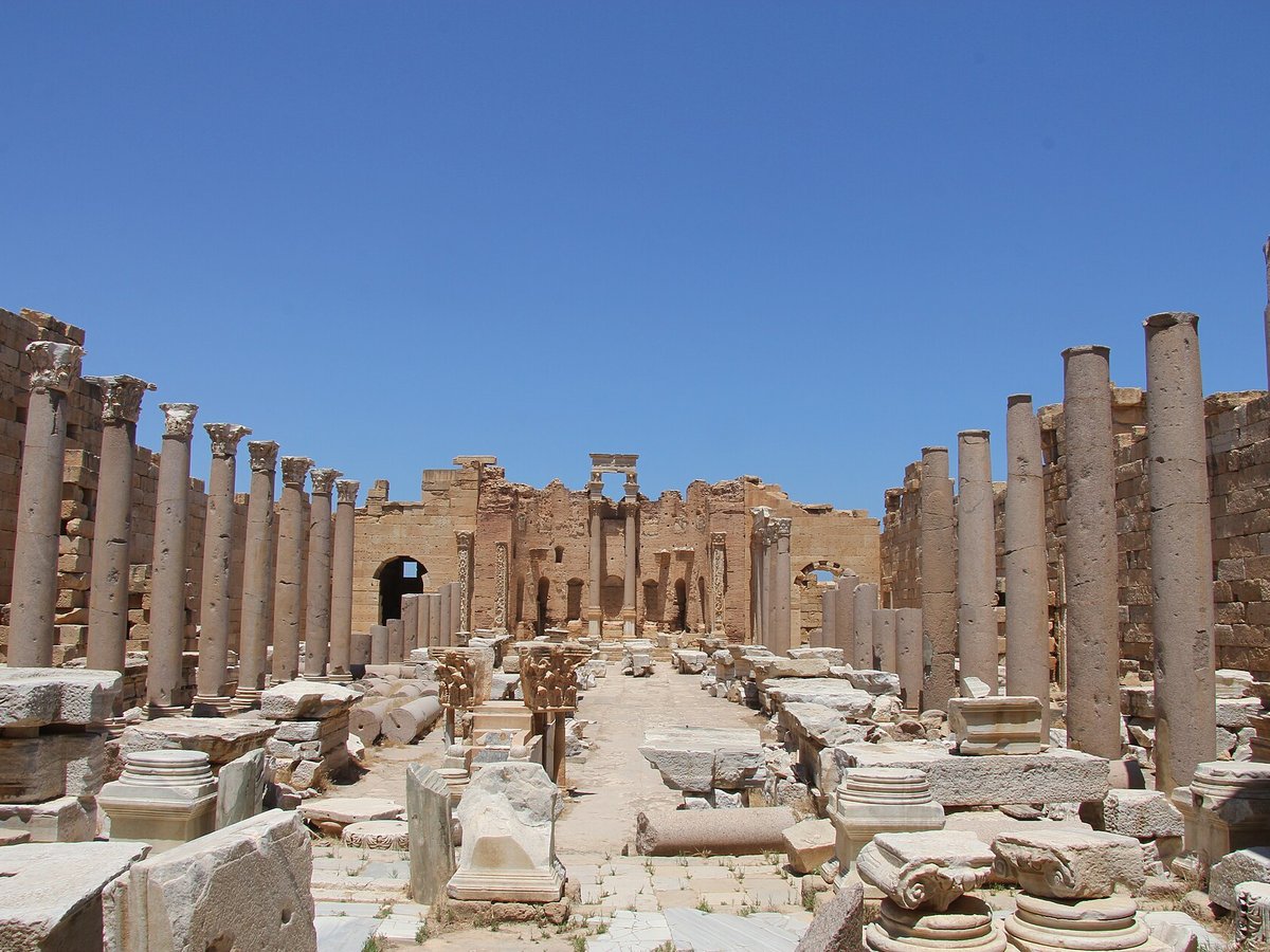
Timgad or Thamugadi (colonia Marciana Traiana Thamugadi in latin, Arabic: تيمقاد, romanized: Tīmqād,), nicknamed the «Pompeii of north africa» was a Roman city in the Aurès Mountains of Algeria.
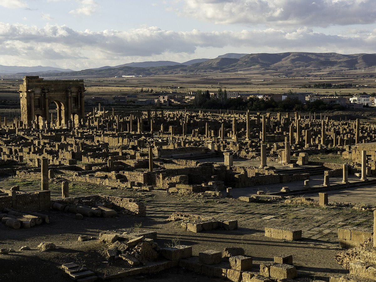
Photo: Dan Sloan via Wikimedia Commons, CC BY-SA 2.0. Cropped and resized for display.
Landmark facts
| Location | Batna, Algeria |
|---|---|
| Type | Historic Site |
| Area | Area: 0.905 km² |
| Coordinates | 35.4842° N, 6.4686° E |
Every fact above is taken from the sources listed below; anything no source states is left blank rather than guessed.
What Timgad is known for
Timgad or Thamugadi (colonia Marciana Traiana Thamugadi in latin, Arabic: تيمقاد, romanized: Tīmqād,), nicknamed the «Pompeii of north africa» was a Roman city in the Aurès Mountains of Algeria.
About Timgad
Timgad or Thamugadi (colonia Marciana Traiana Thamugadi in latin, Arabic: تيمقاد, romanized: Tīmqād,), nicknamed the «Pompeii of north africa» was a Roman city in the Aurès Mountains of Algeria. It was founded by the Roman Emperor Trajan around 100 CE. The full name of the city was Colonia Marciana Ulpia Traiana Thamugadi.
History
In the year 100 CE, the emperor Trajan founded the city as a Colonia. It was intended to serve primarily as a Roman bastion against the Berbers in the nearby Aures Mountains. It was originally populated largely by Roman veterans and colonists.
How to get there
| Nearest town | Batna |
|---|---|
| Nearest airport | Batna Airport (BLJ) |
| Distance from the airport | 17.0 miles (straight line) |
Nearest major airport by straight-line distance from the landmark’s coordinates; road distance will be longer.
Airports near this landmark
The airports a visitor would actually fly into, nearest first — each link opens its profile on our sister site AirportProfiles.
- Batna Mostefa Ben Boulaid Airport (BLJ) · Batna, Algeria · 20.6 miles away
- Mohamed Boudiaf International Airport (CZL) · Constantine, Algeria · 55.4 miles away
- Biskra - Mohamed Khider Airport (BSK) · Biskra, Algeria · 63.1 miles away
Landmarks nearby
The closest landmarks in this library, by straight-line distance.


More historic sites





Frequently asked questions
What is Timgad?
Timgad or Thamugadi (colonia Marciana Traiana Thamugadi in latin, Arabic: تيمقاد, romanized: Tīmqād,), nicknamed the «Pompeii of north africa» was a Roman city in the Aurès Mountains of Algeria.
Where is Timgad located?
Timgad is in Batna, Algeria. Its coordinates are 35.4842° N, 6.4686° E.
How do I get to Timgad?
The nearest town is Batna, and the nearest airport is Batna Airport (BLJ), about 17.0 miles away (straight line).
What is the history of Timgad?
In the year 100 CE, the emperor Trajan founded the city as a Colonia. It was intended to serve primarily as a Roman bastion against the Berbers in the nearby Aures Mountains.
Sources
- https://en.wikipedia.org/wiki/Timgad — Wikipedia article — overview, history and core facts (CC BY-SA).
- https://www.wikidata.org/wiki/Q459629 — Wikidata — built year, architect, height/size, visitors, official website (CC0).
- https://github.com/jbrooksuk/JSON-Airports — Nearest major airport computed from landmark and airport coordinates (haversine); airport list: jbrooksuk/JSON-Airports.
Page last updated 13 November 2026.