
Natural Wonder · Fira, Greece
Santorini
Santorini, officially Thira or Thera, is a Greek island in the southern Aegean Sea, about 200 km (120 mi) southeast from the mainland.
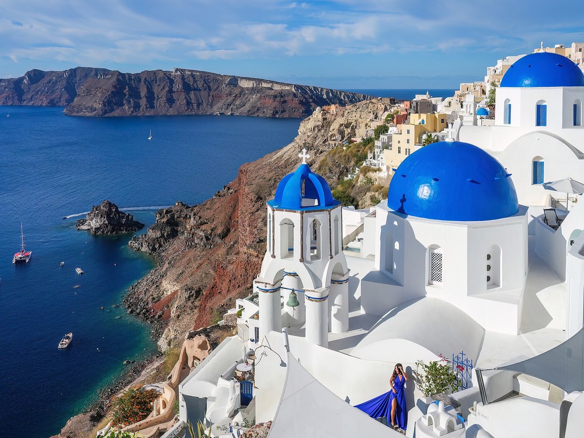
Photo: Giles Laurent via Wikimedia Commons, CC BY-SA 4.0. Cropped and resized for display.
Landmark facts
| Location | Fira, Greece |
|---|---|
| Type | Natural Wonder |
| Elevation | Elevation: 567 m |
| Coordinates | 36.4150° N, 25.4325° E |
Every fact above is taken from the sources listed below; anything no source states is left blank rather than guessed.
What Santorini is known for
Santorini, officially Thira or Thera, is a Greek island in the southern Aegean Sea, about 200 km (120 mi) southeast from the mainland.
About Santorini
Santorini, officially Thira or Thera, is a Greek island in the southern Aegean Sea, about 200 km (120 mi) southeast from the mainland. It is the largest island of a small, circular archipelago formed by the Santorini caldera. It is the southernmost member of the Cyclades group of islands, with an area of approximately 73 km2 (28 mi2) and a 2021 census population of 15,480.
History
The island was the site of one of the largest volcanic eruptions in recorded history: the Minoan eruption, sometimes called the Thera eruption, which occurred about 3,600 years ago at the height of the Minoan civilization. The eruption left a large caldera surrounded by volcanic ash deposits hundreds of metres deep. It has been suggested that the colossal Santorini volcanic eruption is the source of the legend of the lost civilisation of Atlantis.
Planning a visit? Visit the official Santorini website — the official site has the current visiting information.
Best time to visit
April to June and September to October — warm, sunny and far less crowded than July and August.
How to get there
| Nearest town | Fira |
|---|---|
| Nearest airport | Santorini Airport (JTR) |
| Distance from the airport | 2.5 miles (straight line) |
Nearest major airport by straight-line distance from the landmark’s coordinates; road distance will be longer.
Airports near this landmark
The airports a visitor would actually fly into, nearest first — each link opens its profile on our sister site AirportProfiles.
- Santorini International Airport (JTR) · Santorini Island, Greece · 2.8 miles away
- Heraklion International Nikos Kazantzakis Airport (HER) · Heraklion, Greece · 75.6 miles away
- Chania International Airport (CHQ) · Souda, Greece · 94.2 miles away
Landmarks nearby
The closest landmarks in this library, by straight-line distance.

More landmarks in Greece
More natural wonders

Frequently asked questions
What is Santorini?
Santorini, officially Thira or Thera, is a Greek island in the southern Aegean Sea, about 200 km (120 mi) southeast from the mainland.
Where is Santorini located?
Santorini is in Fira, Greece. Its coordinates are 36.4150° N, 25.4325° E.
How do I get to Santorini?
The nearest town is Fira, and the nearest airport is Santorini Airport (JTR), about 2.5 miles away (straight line).
When is the best time to visit Santorini?
April to June and September to October — warm, sunny and far less crowded than July and August.
Sources
- https://en.wikipedia.org/wiki/Santorini — Wikipedia article — overview, history and core facts (CC BY-SA).
- https://www.wikidata.org/wiki/Q129296 — Wikidata — built year, architect, height/size, visitors, official website (CC0).
- https://www.thira.gr — Official website of the landmark / managing body.
- https://github.com/jbrooksuk/JSON-Airports — Nearest major airport computed from landmark and airport coordinates (haversine); airport list: jbrooksuk/JSON-Airports.
- https://www.santorini.com/ — Official tourism / managing-body page — best time to visit.
Page last updated 13 November 2026.