
Natural Wonder · Uyuni, Bolivia
Salar de Uyuni
Salar de Uyuni is the largest salt flat in the world, with an area of approximately 10,582 square kilometres (4,086 mi2).
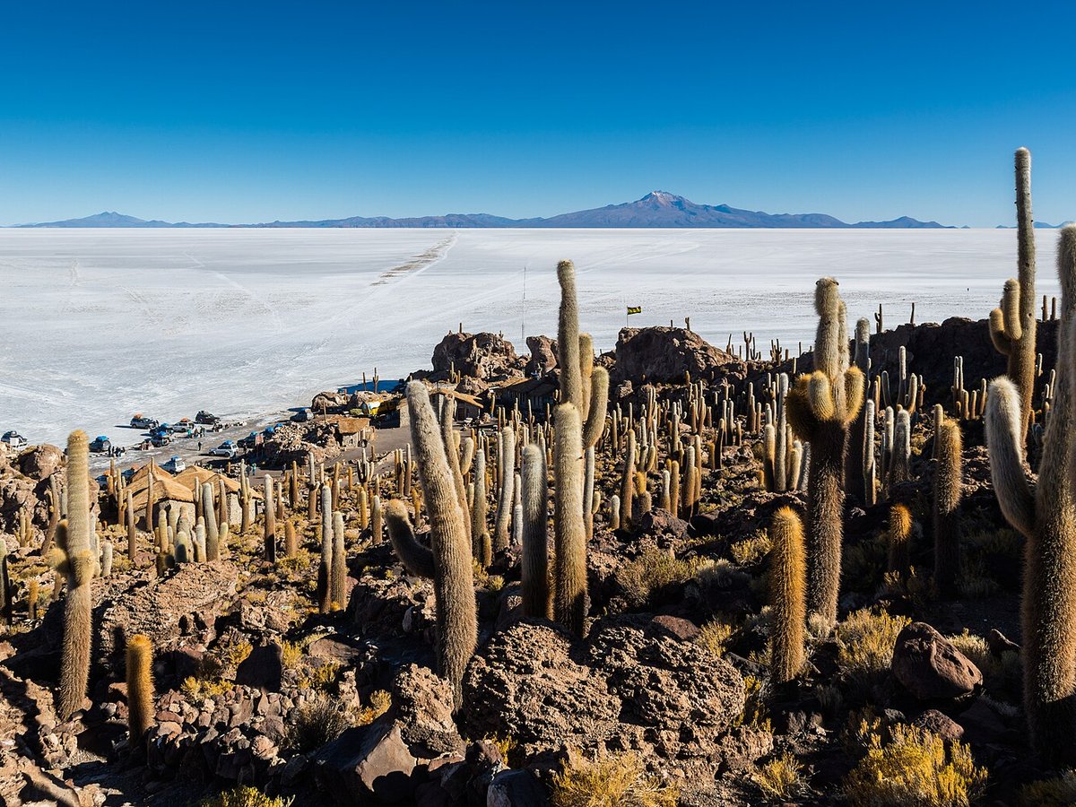
Photo: Diego Delso via Wikimedia Commons, CC BY-SA 4.0. Cropped and resized for display.
Landmark facts
| Location | Uyuni, Bolivia |
|---|---|
| Type | Natural Wonder |
| Length | Length: 140 km |
| Coordinates | 20.1338° S, 67.4891° W |
Every fact above is taken from the sources listed below; anything no source states is left blank rather than guessed.
What Salar de Uyuni is known for
Salar de Uyuni is the largest salt flat in the world, with an area of approximately 10,582 square kilometres (4,086 mi2).
About Salar de Uyuni
Salar de Uyuni is the largest salt flat in the world, with an area of approximately 10,582 square kilometres (4,086 mi2). It is situated in southwestern Bolivia, within the Daniel Campos Province of the Potosí Department, near the crest of the Andes Mountains, at an elevation of 3,656 m (11,995 ft) above sea level. The Salar was formed as a result of transformations of seven Late Pleistocene lakes whose progressive desiccation led to the accumulation of extensive evaporitic salt deposits.
How to get there
| Nearest town | Uyuni |
|---|---|
| Nearest airport | Capitan Nicolas Rojas Airport (POI) |
| Distance from the airport | 121.8 miles (straight line) |
Nearest major airport by straight-line distance from the landmark’s coordinates; road distance will be longer.
Airports near this landmark
The airports a visitor would actually fly into, nearest first — each link opens its profile on our sister site AirportProfiles.
- Joya Andina International Airport (UYU) · Quijarro, Bolivia · 46.1 miles away
Landmarks nearby
The closest landmarks in this library, by straight-line distance.

More natural wonders

Frequently asked questions
What is Salar de Uyuni?
Salar de Uyuni is the largest salt flat in the world, with an area of approximately 10,582 square kilometres (4,086 mi2).
Where is Salar de Uyuni located?
Salar de Uyuni is in Uyuni, Bolivia. Its coordinates are 20.1338° S, 67.4891° W.
How do I get to Salar de Uyuni?
The nearest town is Uyuni, and the nearest airport is Capitan Nicolas Rojas Airport (POI), about 121.8 miles away (straight line).
Sources
- https://en.wikipedia.org/wiki/Salar_de_Uyuni — Wikipedia article — overview, history and core facts (CC BY-SA).
- https://www.wikidata.org/wiki/Q76122 — Wikidata — built year, architect, height/size, visitors, official website (CC0).
- https://github.com/jbrooksuk/JSON-Airports — Nearest major airport computed from landmark and airport coordinates (haversine); airport list: jbrooksuk/JSON-Airports.
Page last updated 13 November 2026.