
Historic Site · Baalbek, Lebanon
Baalbek
Baalbek is a city located east of the Litani River in Lebanon's Beqaa Valley, about 67 km (42 mi) northeast of Beirut.
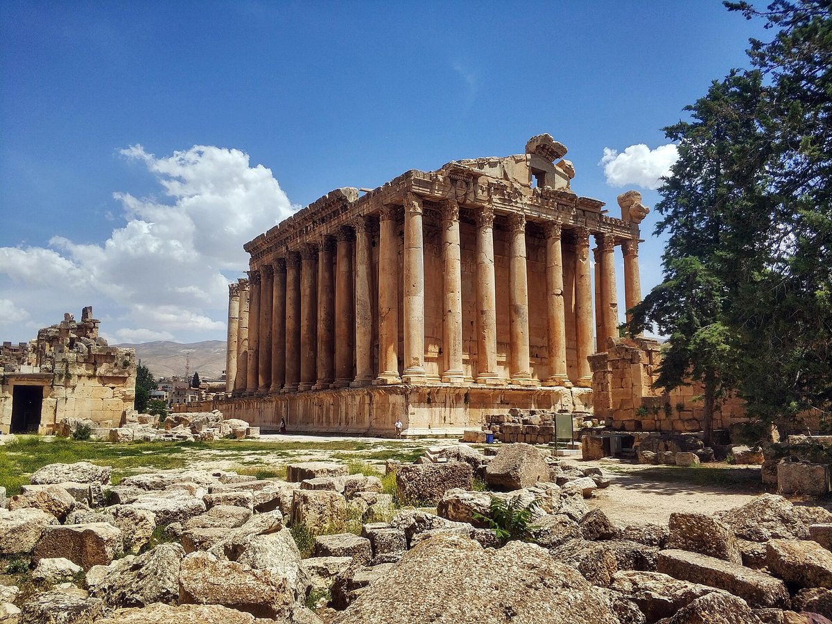
Photo: Lodo from Moscow, Russia via Wikimedia Commons, CC BY-SA 2.0. Cropped and resized for display.
Landmark facts
| Location | Baalbek, Lebanon |
|---|---|
| Type | Historic Site |
| Elevation | Elevation: 1170 m |
| Coordinates | 34.0063° N, 36.2073° E |
Every fact above is taken from the sources listed below; anything no source states is left blank rather than guessed.
What Baalbek is known for
Baalbek is a city located east of the Litani River in Lebanon's Beqaa Valley, about 67 km (42 mi) northeast of Beirut.
About Baalbek
Baalbek is a city located east of the Litani River in Lebanon's Beqaa Valley, about 67 km (42 mi) northeast of Beirut. It is the capital of Baalbek-Hermel Governorate. In 1998, the city had a population of 82,608.
History
The hilltop of Tell Baalbek, part of a valley to the east of the northern Beqaa Valley (Latin: Coele-Syria), shows signs of almost continual habitation over the last 8–9000 years. It was well-watered both from a stream running from the Rās al-ʿAyn spring southwest of the citadel and, during the spring, from numerous rills formed by meltwater from the Anti-Lebanons. Macrobius later credited the site's foundation to a colony of Egyptian or Assyrian priests.
How to get there
| Nearest town | Baalbek |
|---|---|
| Nearest airport | Beirut Rafic Hariri International Airport (BEY) |
| Distance from the airport | 42.8 miles (straight line) |
Nearest major airport by straight-line distance from the landmark’s coordinates; road distance will be longer.
Airports near this landmark
The airports a visitor would actually fly into, nearest first — each link opens its profile on our sister site AirportProfiles.
- Beirut Rafic Hariri International Airport (BEY) · Beirut, Lebanon · 43.2 miles away
- Damascus International Airport (DAM) · Damascus, Syria · 44.8 miles away
- Marka International (Amman Civil) Airport (ADJ) · Amman, Jordan · 141.1 miles away
Landmarks nearby
The closest landmarks in this library, by straight-line distance.
More landmarks in Lebanon
More historic sites





Frequently asked questions
What is Baalbek?
Baalbek is a city located east of the Litani River in Lebanon's Beqaa Valley, about 67 km (42 mi) northeast of Beirut.
Where is Baalbek located?
Baalbek is in Baalbek, Lebanon. Its coordinates are 34.0063° N, 36.2073° E.
How do I get to Baalbek?
The nearest town is Baalbek, and the nearest airport is Beirut Rafic Hariri International Airport (BEY), about 42.8 miles away (straight line).
What is the history of Baalbek?
The hilltop of Tell Baalbek, part of a valley to the east of the northern Beqaa Valley (Latin: Coele-Syria), shows signs of almost continual habitation over the last 8–9000 years. It was well-watered both from a stream running from the Rās al-ʿAyn spring southwest of the citadel and, during the spring, from numerous rills formed by meltwater from the Anti-Lebanons.
Sources
- https://en.wikipedia.org/wiki/Baalbek — Wikipedia article — overview, history and core facts (CC BY-SA).
- https://www.wikidata.org/wiki/Q178835 — Wikidata — built year, architect, height/size, visitors, official website (CC0).
- https://github.com/jbrooksuk/JSON-Airports — Nearest major airport computed from landmark and airport coordinates (haversine); airport list: jbrooksuk/JSON-Airports.
Page last updated 13 November 2026.